
Find Your Way Around Kabetogama Lake
From hiking trails to winter routes and nearby ATV systems, these maps help you explore Kabetogama Lake and Voyageurs National Park with ease.
Whether you are planning ahead or already here,
everything you need to get oriented starts right here.
Jump to:
VNP Park Overview | VNP Day Use Sites | VNP Campsites | VNP Houseboats
Voyageurs National Park Map
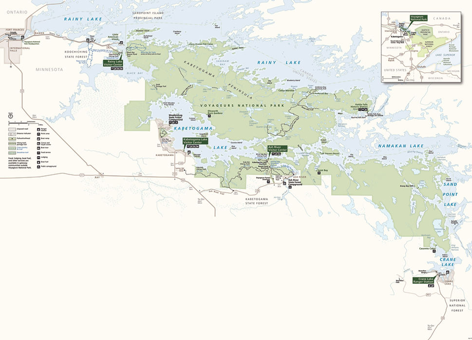
For more detailed Voyageurs National Park maps and information, please visit the National Park Service's website.
Voyageurs National Park Day Use Map

Ellsworth
Rock Gardens
Kabetogama Lake
Visitor Center
Hacksaw Pass
Martin
Island
Moxie
Island
Locator
Lake
Shoepack Beach
Round Bear Island
Ash River Visitors Center
Hoist Bay
Sheen
Point
Kettle
Falls
For more detailed Voyageurs National Park maps and information, please visit the National Park Service's website.
Voyageurs National Park Campsites
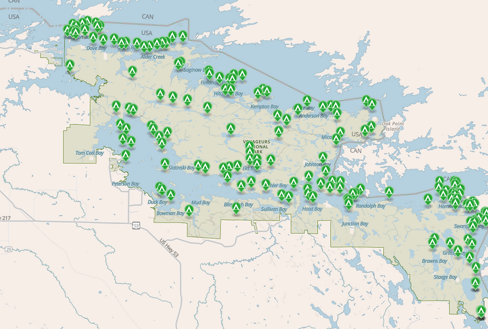
For more detailed Voyageurs National Park maps and information, please visit the National Park Service's website.
Reservations for Voyageurs National Park campsites can be on the Recreation.gov website.
Voyageurs National Park Houseboat Sites

For more detailed Voyageurs National Park maps and information, please visit the National Park Service's website.
Reservations for Voyageurs National Park campsites can be on the Recreation.gov website.
Hiking in Voyageurs National Park
The maps below highlight individual hiking trails and route areas within Voyageurs National Park, with a focus on the Kabetogama Lake and Ash River areas. These are detailed, zoomed-in maps designed to help you navigate specific trails, not the entire park.
For a full list of hiking trails, current conditions, and trip planning information, visit the National Park Service website.
Some trailheads, including those along the Kab Ash Trail, are located closer to primitive campsites and tend to be more frequently traveled. Other sections may be less maintained and can become overgrown, so planning ahead is recommended.


Snowmobile Trail Maps
Snowmobiling around Kabetogama Lake and Voyageurs National Park offers miles of scenic winter trails through forests, across frozen lakes, and into some of the most remote and beautiful parts of northern Minnesota.
Snowmobile trails in this area are supported by a network of local and regional organizations, including the Voyageur Trail Society, which works to preserve and protect the natural beauty of Voyageurs National Park and the surrounding region.
For the latest conditions, visit → Voyageur Trail Society or → Minnesota Department of Natural Resources.
Use the maps below to explore trail routes, access points, and connections throughout the Kabetogama area.


ATV Trails Map
While Kabetogama Lake is not currently connected to an official ATV trail system, it is easy to access nearby routes within the Voyageur Country Trail system.
These trails offer miles of riding through northern Minnesota’s forests, wetlands, and scenic backcountry, with a variety of routes for different experience levels.
Use the maps below to explore access points and nearby trail connections. For the most up to date trail information, conditions, and route details, you can also contact the Voyageur Country ATV Club.
